The Defence Science and Technology Laboratory’s (Dstl) miniaturised space weather instrumentation suite will be one of the payloads aboard Virgin Orbit which is targeting the first UK satellite launch this summer from Spaceport Cornwall in Newquay. Virgin Orbit’s Launcher One rocket takes off horizontally, carried aloft by a modified Boeing 747 jet, named Cosmic Girl.
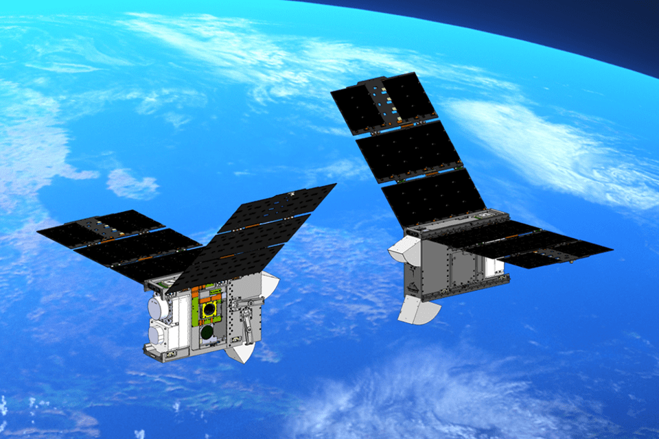
The Coordinated Ionospheric Reconstruction Cubesat Experiment (CIRCE) satellite mission comprises two 6U cube-satellites that will be launched into a near-polar low Earth orbit in a string-of-pearls configuration (targeting 555 kilometres altitude). Each 6U satellite bus measures 10cm by 20cm by 30cm (the size of a cereal box), and will fly almost identical instrument capability on both satellites. Dstl is partnering with the US Naval Research Laboratory (NRL) on the joint mission.
The UK contribution to CIRCE is the In-situ and Remote Ionospheric Sensing (IRIS) suite, complementary to NRL sensors and comprising 3 highly miniaturised payloads developed for Dstl by University College London (UCL), University of Bath, and Surrey Satellite Technology Ltd (SSTL), drawing on expertise from the University of Surrey. CIRCE will characterise a region of the space environment, the ionosphere, which is important for a range of defence and civil applications and can impact GPS, communications and sensing technology – both in space and on the ground.
All 3 IRIS payloads together occupy a small volume no more than 10cm by 10cm by 20cm. Miniaturisation of space weather sensors means that a significant capability is packed into each satellite bus provided by Blue Canyon Technologies. This type of miniaturisation could pave the way for deployment of many more such sensors as a routine inclusion on other satellites thanks to their small size, weight and power. The result would expand data collection for the near-Earth space environment, and enhance space weather modelling capabilities.
Understanding space weather is crucial to the safe operation of satellites. Solar flares and geomagnetic storms can severely impact satellites in space, as highlighted by the recent loss of 40 Space X Starlink satellites in February 2022.

During the mission the satellites will be operated from a series of ground stations in conjunction with international partners. As well as data collection, the miniature satellites will act as technology demonstrators, with their utility and performance being assessed to de-risk future missions.
A unique aspect of the CIRCE mission is the ability to characterise the same volume of space within a very short return period, enabled by the constellation of 2 near identical spacecraft actively maintaining a lead-follow configuration in the same low Earth orbit, separated by 250 to 500 kilometres. A single satellite in low Earth orbit has an approximately 90 minute revisit period; a multi-satellite constellation would improve on this, but it is the dual-nature of the 2 relatively closely-spaced CIRCE satellites that is anticipated to provide unique insights into the temporal dynamics associated with specific ionospheric structures.
Air Vice-Marshal Paul Godfrey, Commander of UK Space Command, said:
Defence science and technological activity in space has never been more important, whether it is in support of military operations or helping to combat climate change, defence innovation is at the forefront of this work. After it enters orbit from Spaceport Cornwall, CIRCE will enhance our understanding of space weather and help us to keep critical satellites safe from the many hazards associated with operating in space.
Dr Paul Hollinshead, Dstl Chief Executive, said:
The CIRCE mission showcases the UK’s academic and industry space capabilities and extends the physical boundaries of our collaboration. This joint endeavour with our US partners shows there are no limits to what can be achieved with our international allies.
Dr Paul Bate, CEO of the UK Space Agency, said:
The CIRCE space weather experiment will join a host of small satellites on board Virgin Orbit’s first launch from the UK, and it’s exciting to see the wide range of commercial, academic and government partners who will share this moment in history with us. We are on track to meet our ambition of becoming the first country to offer commercial launch services from Europe, catalysing investment into our growing space sector and creating hundreds of new jobs. I can’t wait to see Cosmic Girl take to the skies above Spaceport Cornwall later this year.
Melissa Thorpe, Head of Spaceport Cornwall, said:
It’s an honour that critical UK and US partnerships are to be launched from Cornwall and we are proud to support the facilitation of these international milestones. The mission aligns with Spaceport Cornwall’s delivery of ‘space for good’, by bringing together partners from across the planet in a shared mission to support transformational space-to-planet communications and applications to benefit humanity.
Notes to editors
IRIS
IRIS provides in-situ ionospheric particle and radiation measurements (INMS and RadMon), combined with remote-sensing of triple-frequency GPS signals to map the topside ionosphere and beyond (TOPCAT). The UK data will provide useful information in their own right, as well as providing contextual environmental information for CIRCE, and enrich the science that can be derived from NRL’s triple tiny ionospheric photometry (Tri-TIP) ultra violet optics cameras, for tomographic specification of electron density.
The IRIS suite, integrated by SSTL, includes:
- An Ion and Neutral Mass Spectrometer (INMS), developed by UCL’s Mullard Space Science Laboratory, which will improve understanding of the variability of atmospheric drag, the chemistry of the thermosphere and the impact of space weather on the upper-atmosphere;
- A Radiation Monitor (RadMon) from SSTL will identify areas of increased radiation for satellites to avoid, help identify suitable orbits and shielding requirements for future satellites, and highlight dynamic radiation enhancements that can be cross-correlated with payload and subsystem anomalies;
- TOPCAT, developed by Bath University’s department of Electronic and Electrical Engineering, which will look at remote sensing of triple-frequency GPS signals, and validate the UK’s Multi-Instrument Data Analysis System (MIDAS) tomography algorithm for the topside ionosphere and plasmasphere, by using total electron content (TEC) measurements from the differential phase of GPS signals, inverting them to derive the electron density of the region.
Find out more about Dstl’s space defence science and technology capability.

